

Open roads and a chance to see a volcano
Story and photos: The Bear
New Zealand’s South Island tends to get most of the exposure, but the North Island has its attractions too.
I tried to take this seriously, I really did. I must have asked three dozen New Zealanders (Kiwis) whether they remembered the Forgotten World Highway, and they all said “yus”. Not all of them had been there, but they knew of it. It seems then that the name belongs with the tag Ninety Mile Beach, which is also an exaggeration. But while there is an explanation for the beach mistake – the pakeha who originally rode it got the distance wrong because the sand was soft (yeah, well, in Unzud that counts as an explanation) the highway is supposedly called that because it’s old (by antipodean standards) and runs through rugged country.
I would have thought that the fifty years it took to complete it would have made it pretty memorable, and most roads in Unzud run through rugged country anyway, but there you go.
But no matter. The highway lies largely in King Country, called that by Kiwis because it was there that Tawhiao, a Māori king, sought refuge in 1865 following the New Zealand Wars. They used to be called the Māori Wars, but that has been politically corrected. The region remained under Māori control until 1881, when it was finally surrendered to the government. The rest of the road lies in Manawatu–Wanganui and Taranaki, which for reasons I don’t care to speculate about has given its name to precarious, cheap jerry-rigged fences and gates.
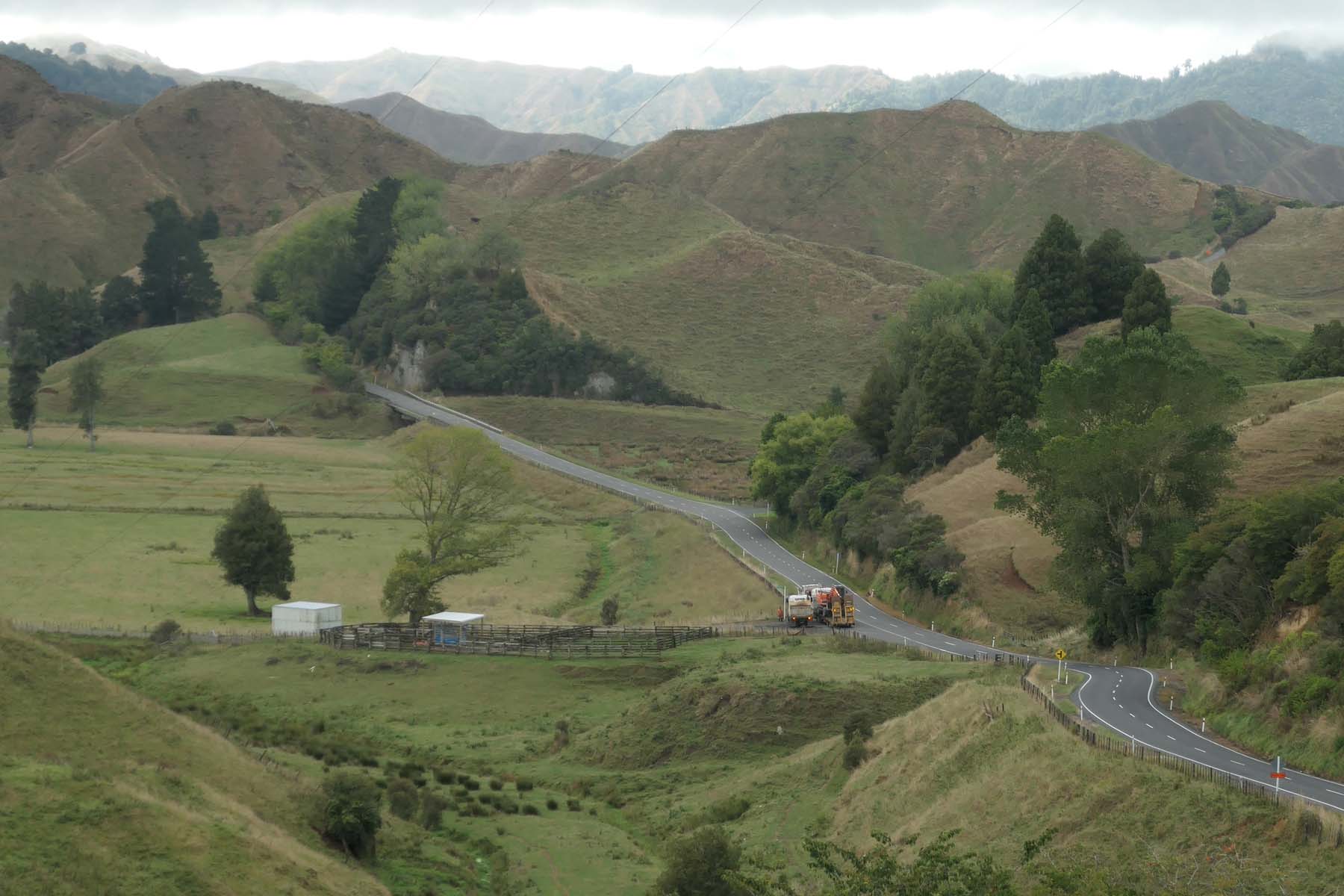
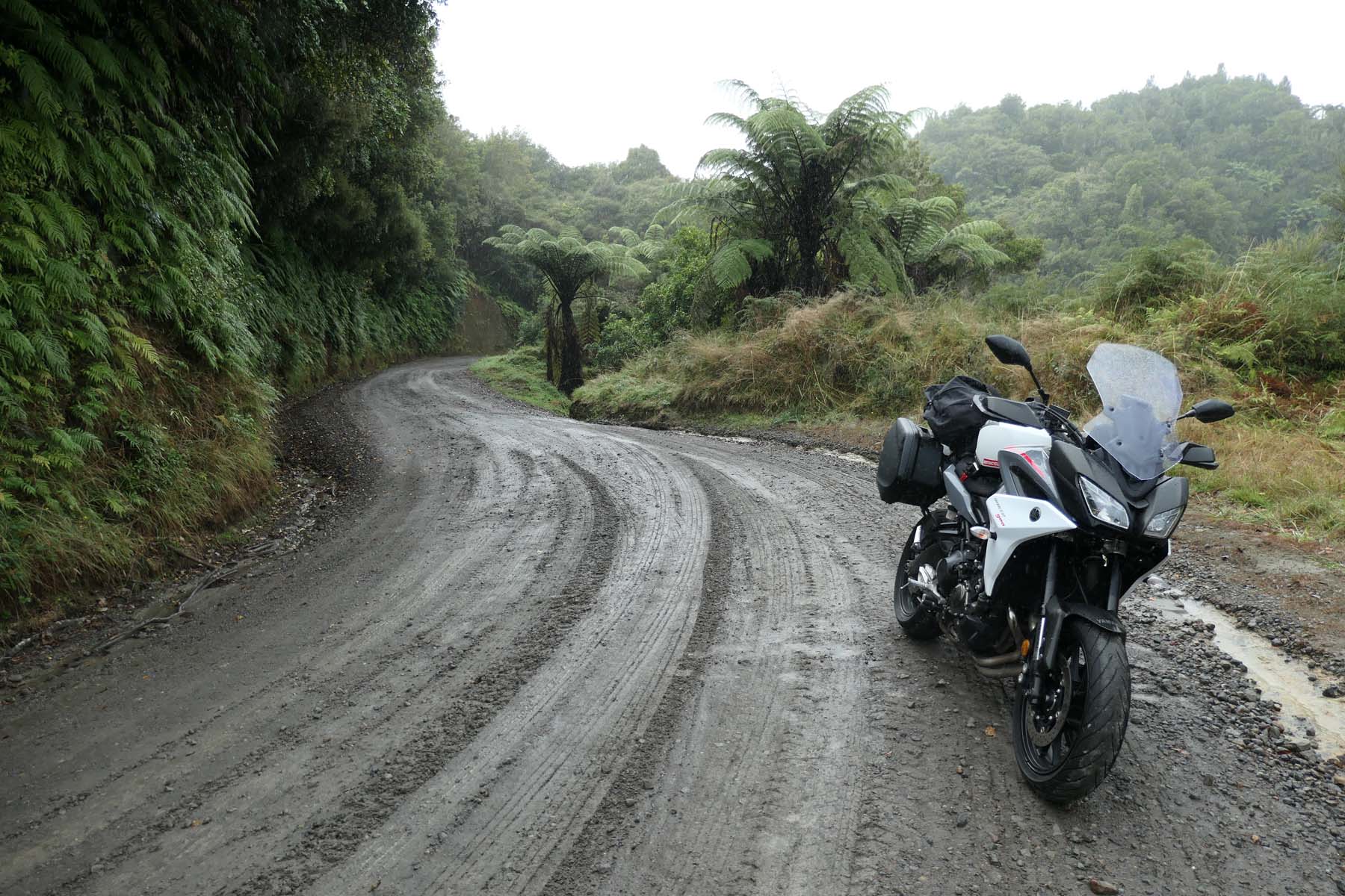
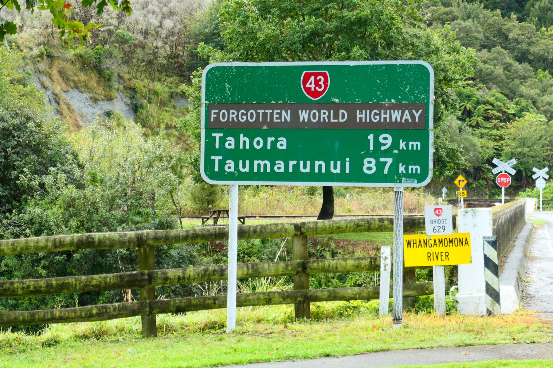
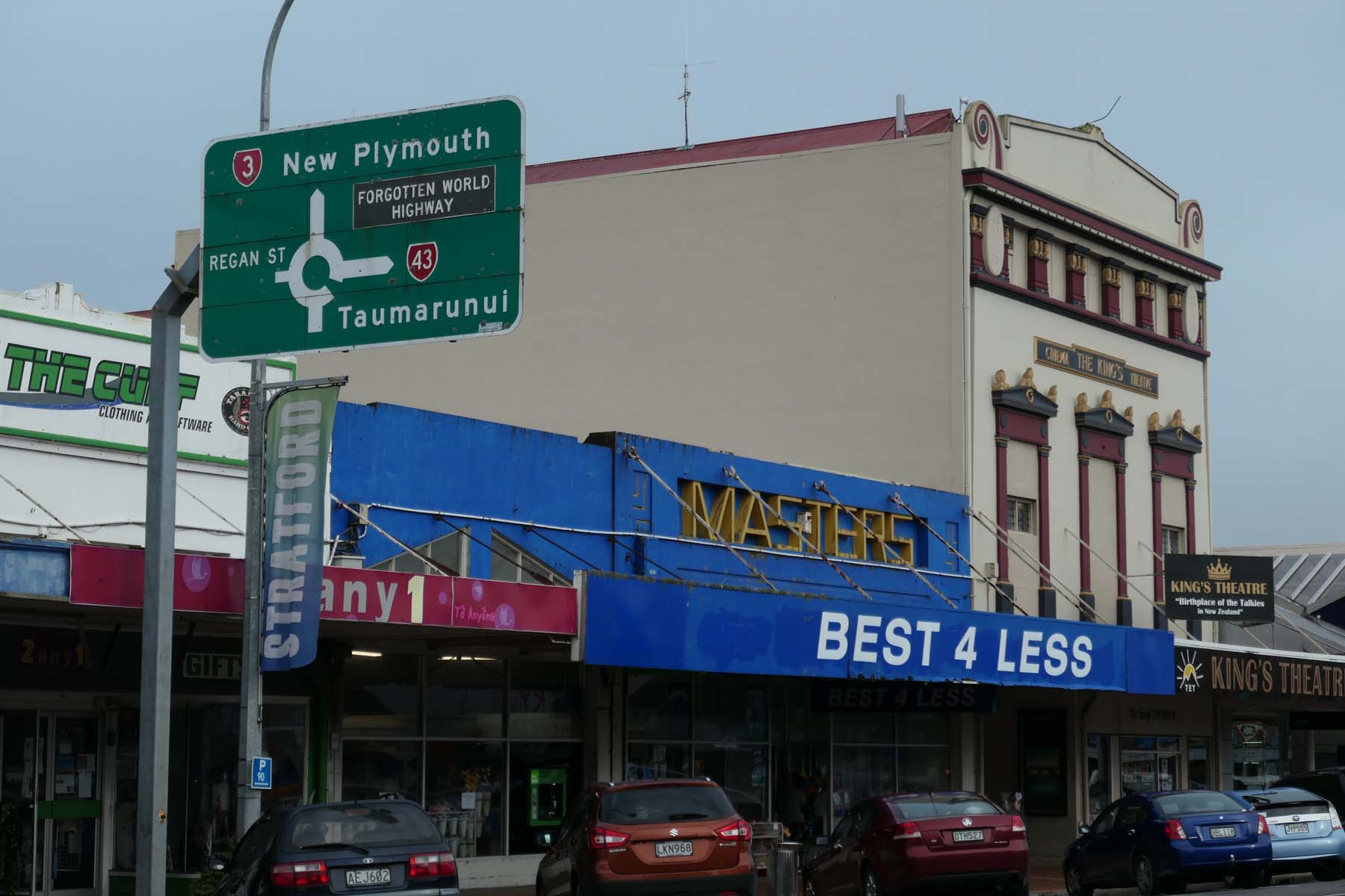
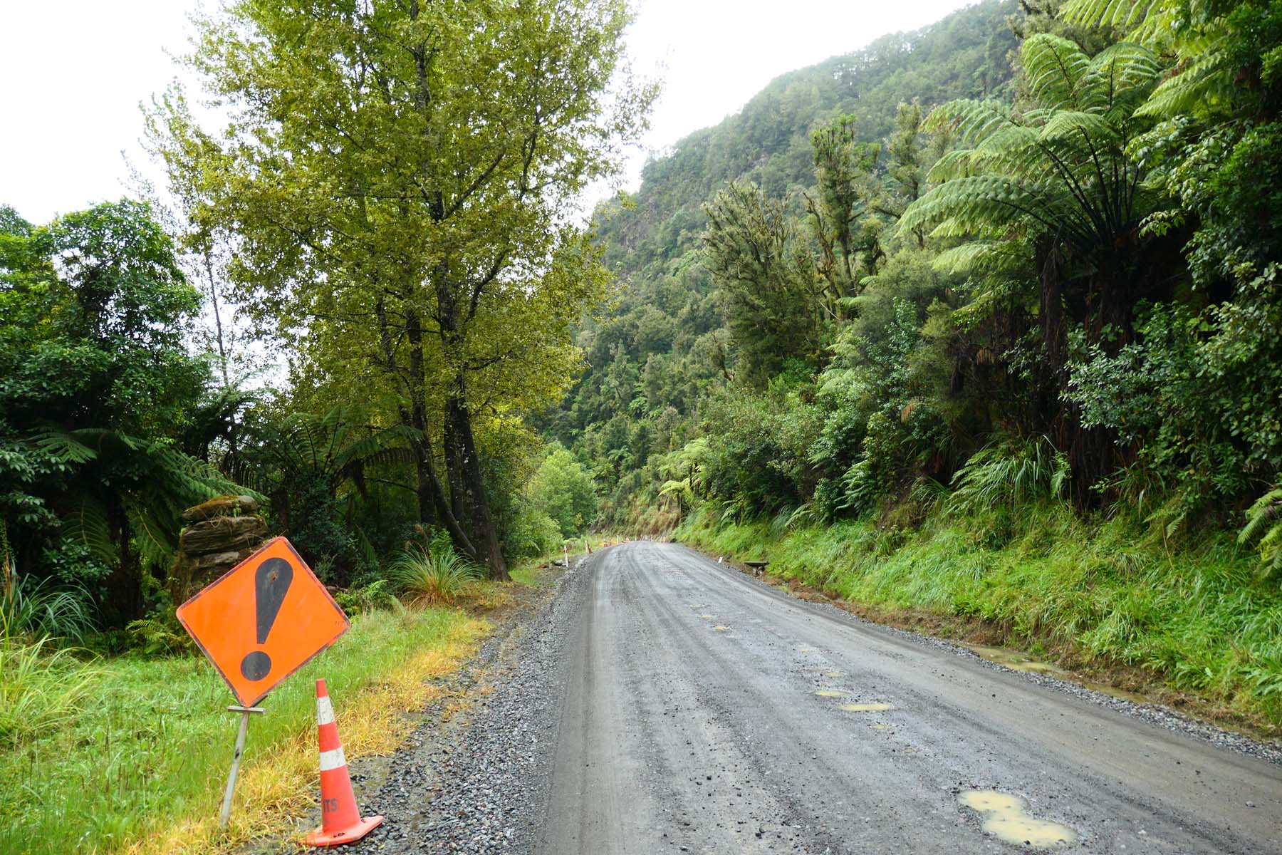
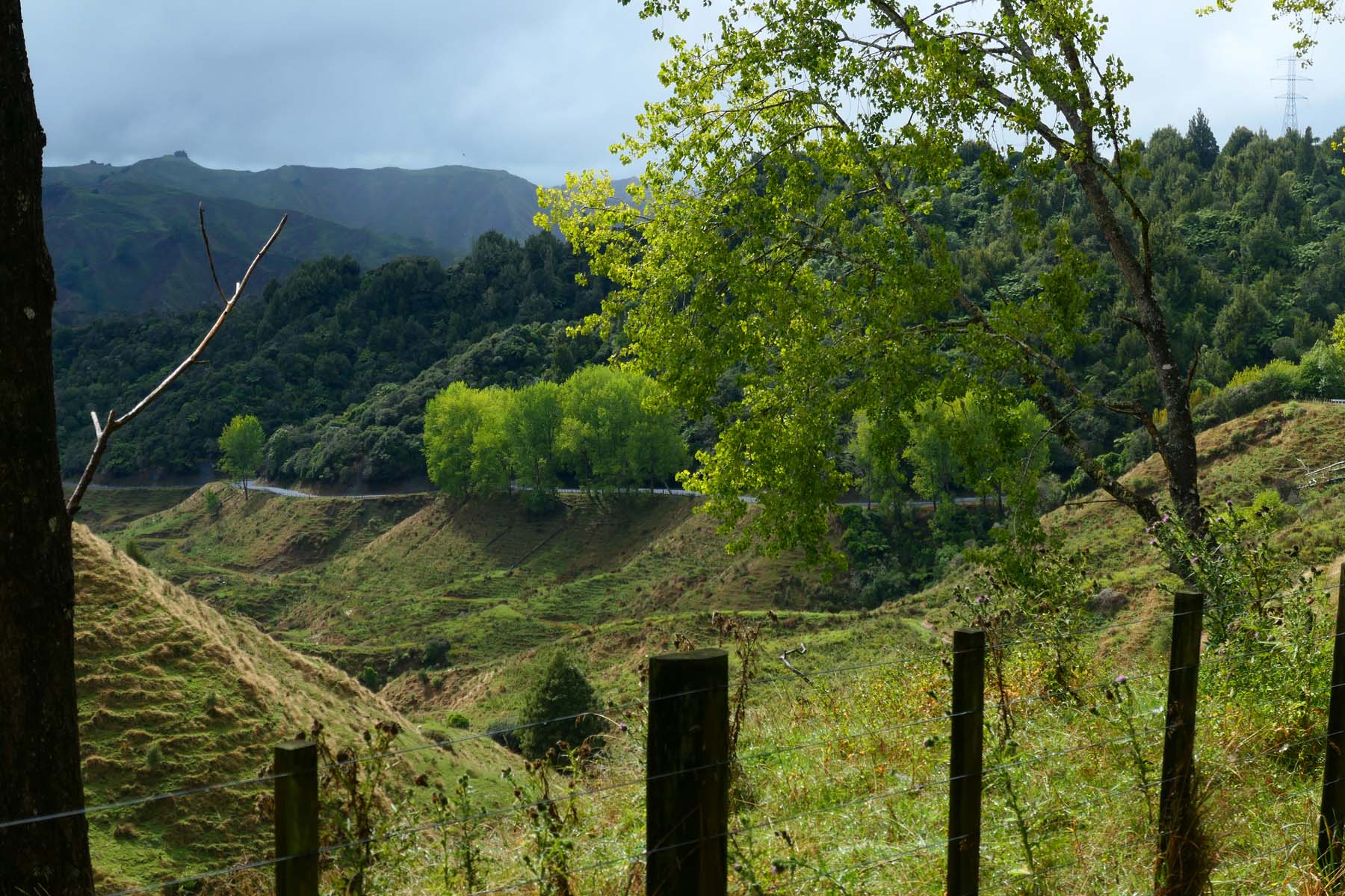
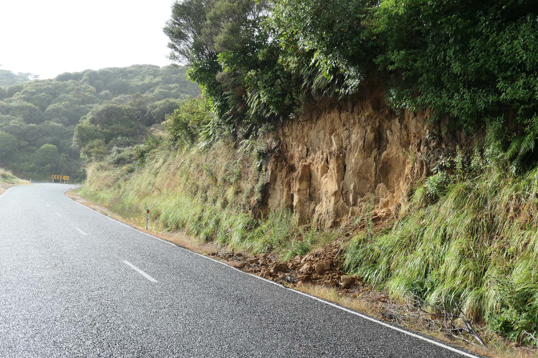
The Forgotten World Highway is New Zealand State Highway 43 (SH43) and runs 148 km from Stratford to Taumarunui. When I last rode it, it contained the only unsealed portion of the New Zealand state highway network – some 12km of fairly good gravel. SH43 has been ranked as one of the ten worst roads in New Zealand by the cops. It seems that the gravel surface in the Tangarakau Gorge is the main cause of the highway's bad safety record. It’s not a worry on a bike, trust me. Even in 1982 when I first rode it and when it was mostly not-so-good gravel, the road was pretty safe because I had to ride slowly to take in all the scenery.
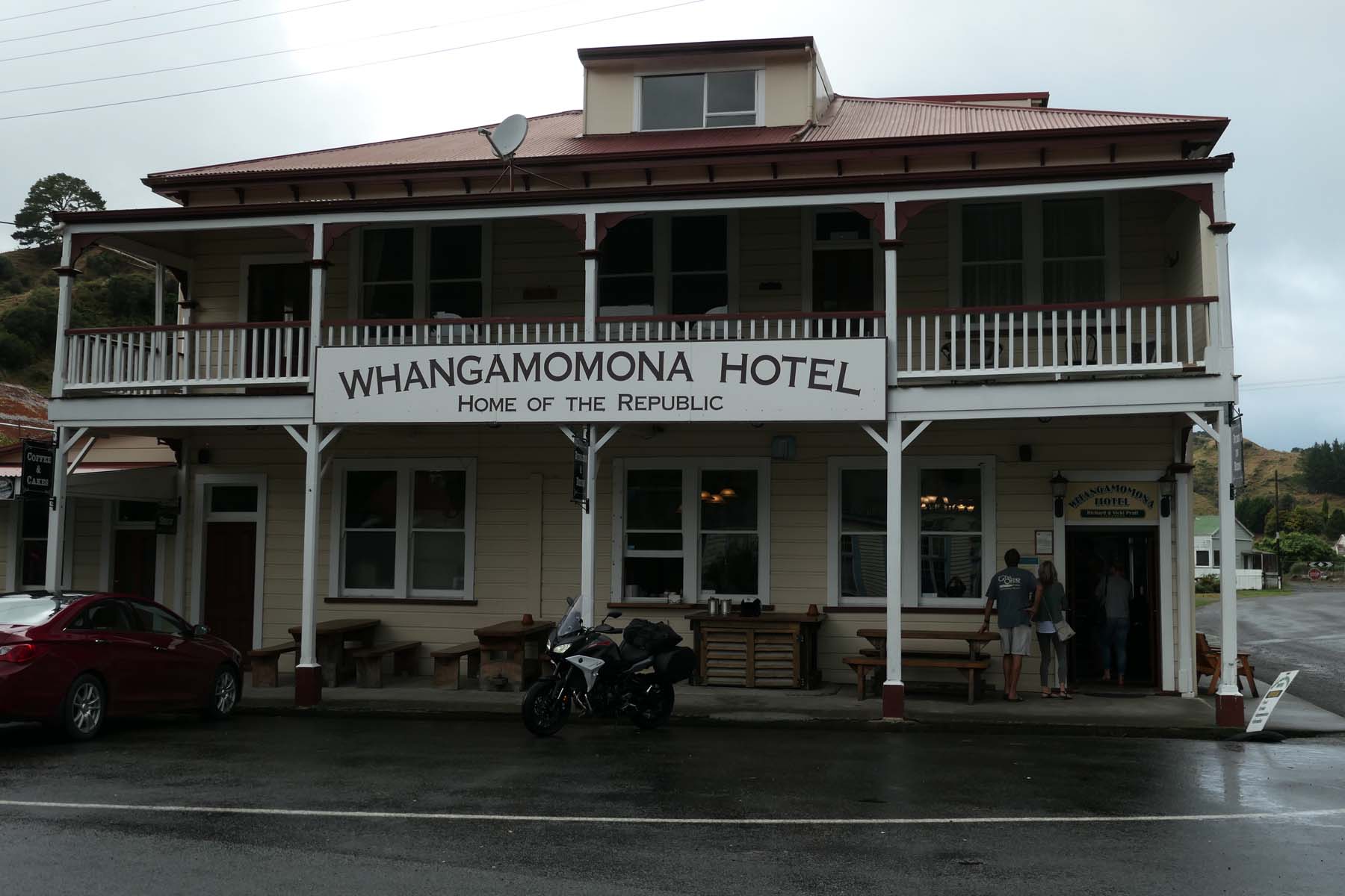
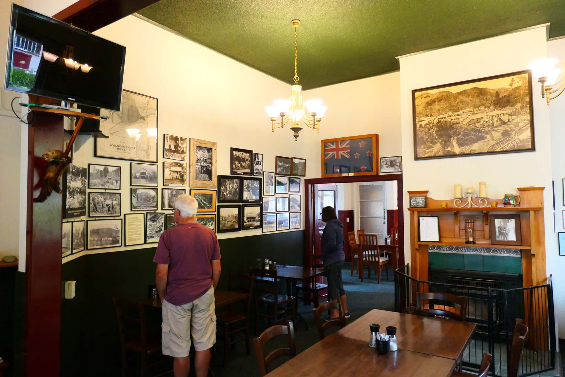
The road supposedly passes through small towns such as Toko, Douglas, Te Wera, Pohukura, Strathmore, Whangamōmona, Marco, Koruatahi, Tahora and Tatu. Almost all of these are ghost towns which died when the railway did. Do not count on being able to get fuel or anything else other than curious looks except in the Republic of Whangamōmona, where there is a pub which supplies beer and reasonable tucker.
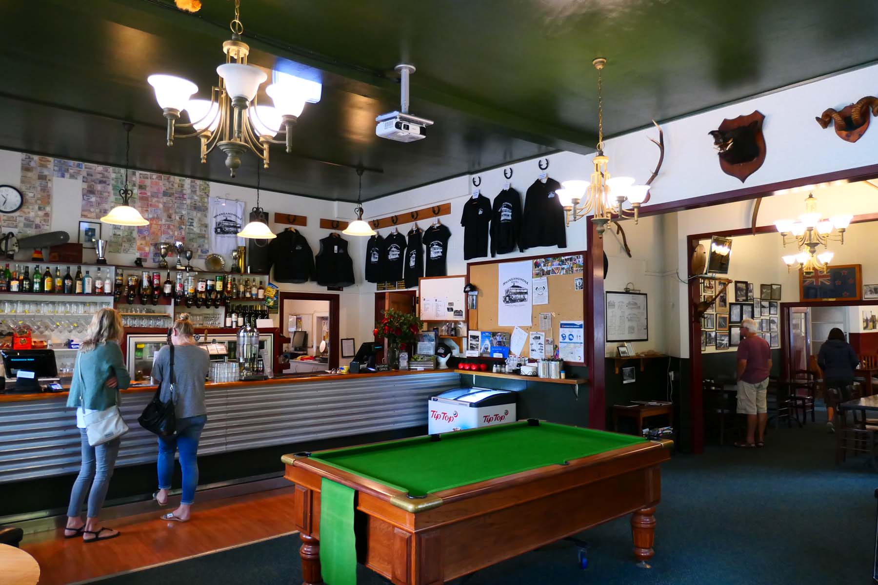
The cause of the declaration of the Republic of Whangamōmona on November 1, 1989, was the announcement that the eastern part of Taranaki was to become part of Manawatu–Wanganui. Locals were not impressed and declared their “independence”, which immediately made the place a tourist attraction. It is also one terminal of the Taumarunui Rail Car route, described with usual Kiwi modesty as “indeed unique… guided rail cart experiences along a genuine, old railway line… bursting with history of pioneers and incredible feats of engineering”. I haven’t tried it.
Considering that it is “forgotten”, SH34’s surface is mostly in good condition. The Kiwis know that they need to look after visitors, a habit that goes back to the early days when whalers called at Māori settlements and were accommodated in various ways in exchange for guns. These days everybody takes money and guns are quite tightly controlled.
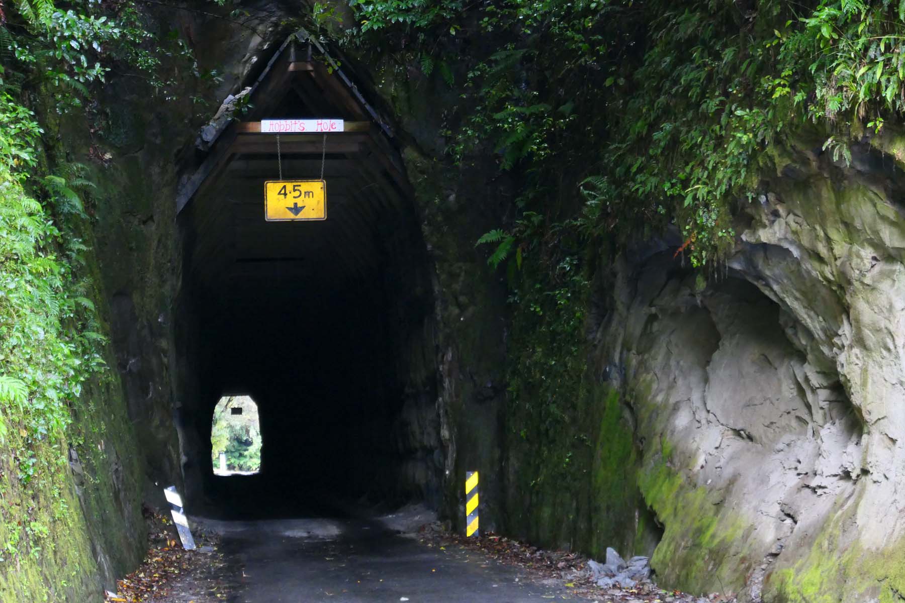
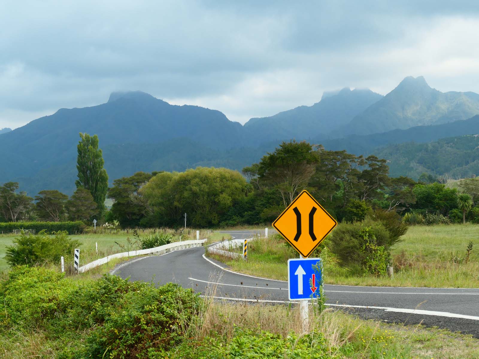
It takes less than three hours to ride the highway if you go straight through but of course that’s a bit of a waste. You’ll find yourself stopping for photos or even just a look at the vistas which open up as you cross the Strathmore, Whangamōmona and Tahora saddles. Also worth a stop is the Moki Tunnel, better known as Hobbit's Hole. Near one end is the turn off for Mount Damper Falls, (the fourth-highest in the North Island, in case you’re keeping track. Past the other end is Tangarakau Gorge with that gravel surface unless they’ve sealed it recently, with walls just under 60m high.
So remember the Forgotten World Highway. We might take a look at Ninety Mile Beach some time, too.